|
Edited on Thu Feb-07-08 11:04 AM by nealmhughes
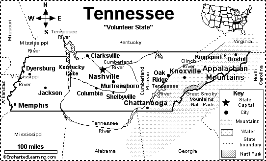
The Tennessee starts in the mountains of VA, NC and TN as smaller streams meet and join around Knoxville, and then follows the rational method of water flow, i.e., downhill.
At Chattagooga it makes the first Big Bend and flows due west through North Alabama, then makes the second Big Bend to go straight north thru Tennessee and Kentucky to the Ohio then the Mississippi at Paducah/Cairo.
The mountains are between Atlanta and the Tennessee, which means unless they are going to do some gigantic hydraulic dam products and raise the level of water above the mountains between Atlanta and the river or else try to use a pipeline and boar through the mountains, then a series of pumping stations will be required to get the postulated water from the Tennessee to Atlanta.
Along the way, the state of Georgia will find itself at war with the TVA, Army Corps of Engineers, Alabama, Tennessee, and possibly Mississippi and Kentucky, since these would all be downstream of any postulated Atlanta tap. Navigation cannot be impeaded on the navigatable portions of the Tennessee (basically most of it) and there are several endangered species that live in the River and its tribs.
If Georgia thinks they can call dibs on the Tennessee, they are sadly mistaken, TVA controls the river, and one needs a speial permit to even put a boat pier onto the river, much less take water from it or its watershed!
From a hydraulic viewpoint: Atlanta has outgrown its water supply. The answer: have a portion of the population move to Chattanooga, Nashville, Memphis, or Huntsville, or even Knoxville due to the great rivers flowing through these cities!
One barge stuck at the main lock at Wilson Dam on the Tennessee paralyzed river traffic two years ago, and barges were backed up from Decatur well up into Tennessee past Waterloo, over 75 miles in Alabama last year as only the smaller aux lock could be used. The river level is carefully controlled by TVA for mosquito control, navigation, and aesthetic reasons. It is lowered in the winter, making sandbars and islets visible on the creeks that feed into the Tennessee that normally are not, and then the level is raised as the weather warms.
An adequate water height is required for industrial purposes as well as navigation, and that includes the three Browns Ferry and several Soddy Daisy nuclear power plants that TVA runs on the Tennessee, and the very major hydro dams on the river: Watts Bar, Guntersville, Wheeler, Wilson, and Pickwick. These dams impound water that form the lakes on the Tennesse in Tennessee, Alabama, and Mississippi as well as make navigation possible: in short, Georgia might as well try to hire a rain maker and a faith healer than to think that this would ever be approved by the several states that are on the Tennessee, their commercial interests, and the various federal agencies that would be affected.
Who would benefit: the lawyers! No one else as this would be tied up for the longest law suits in US history!
|