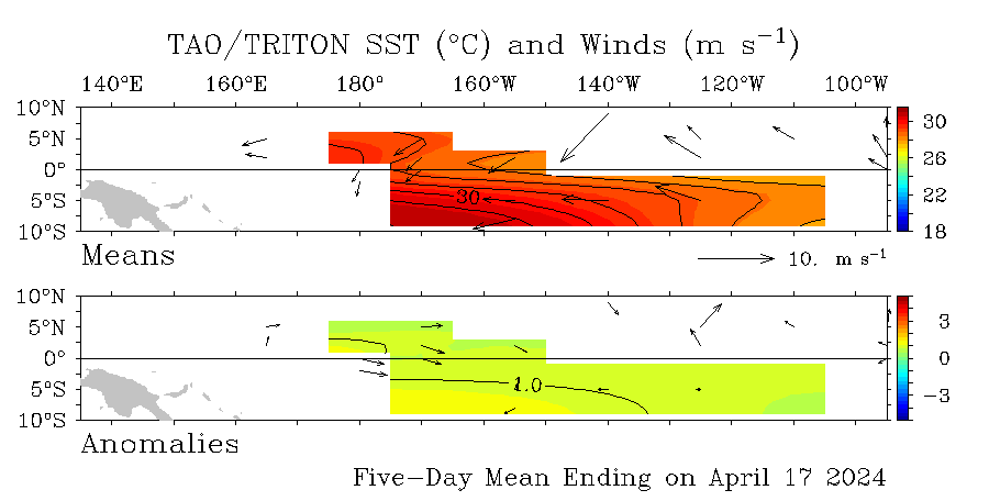
SST and SST anomoloies in the equatorial pacific.
--------------------
Sept. 10, 2004 — NOAA declared today that El Niño is back but this time around in a weaker state. "El Niño conditions have developed in the tropical Pacific and are expected to last through early 2005," said Jim Laver, director of the NOAA Climate Prediction Center. "At this time it is not clear what, if any, impacts this event will have on ocean temperatures in the classical El Niño region along the west coast of South America and on temperature and precipitation in the United States." (Click the NOAA satellite image for larger view of El Niño taken Sept. 7, 2004. The warm sea surface temperatures in the eastern Pacific Ocean are represented in red.
In the release of the El Niño Diagnostic Discussion, the NOAA Climate Prediction Center scientists noted that sea surface temperatures (SSTs) were more than 0.5 degrees C above average in the central and western equatorial Pacific during August 2004. By early September, positive SST departures greater than 0.5 degrees C (~1 degree F) were found between 160 E and 120W, with departures greater than 1 degree C extending from 170 E eastward to 140 W.
NOAA declares the onset of El Niño conditions when the three-month average sea-surface temperature departure exceeds 0.5 degrees C in the east-central equatorial Pacific
. To be classified as a full-fledged El Niño episode, these conditions must be satisfied for a period of at least five consecutive three-month seasons.
http://www.noaanews.noaa.gov/stories2004/s2317.htm