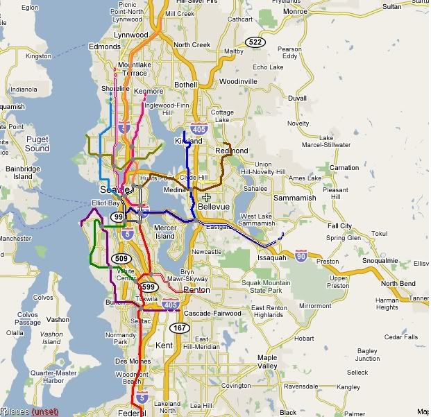
Unless all the neighborhoods in Seattle are served, and large portions of the eastern suburbs, I think light rail will not do a lot toward reducing traffic. I freely admit that I am not as familiar with the northern and southern parts of the area covered as I am with Seattle and the east side. Comments, of course, are welcome.

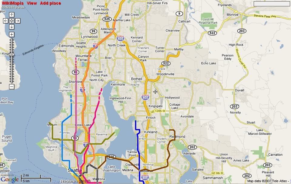
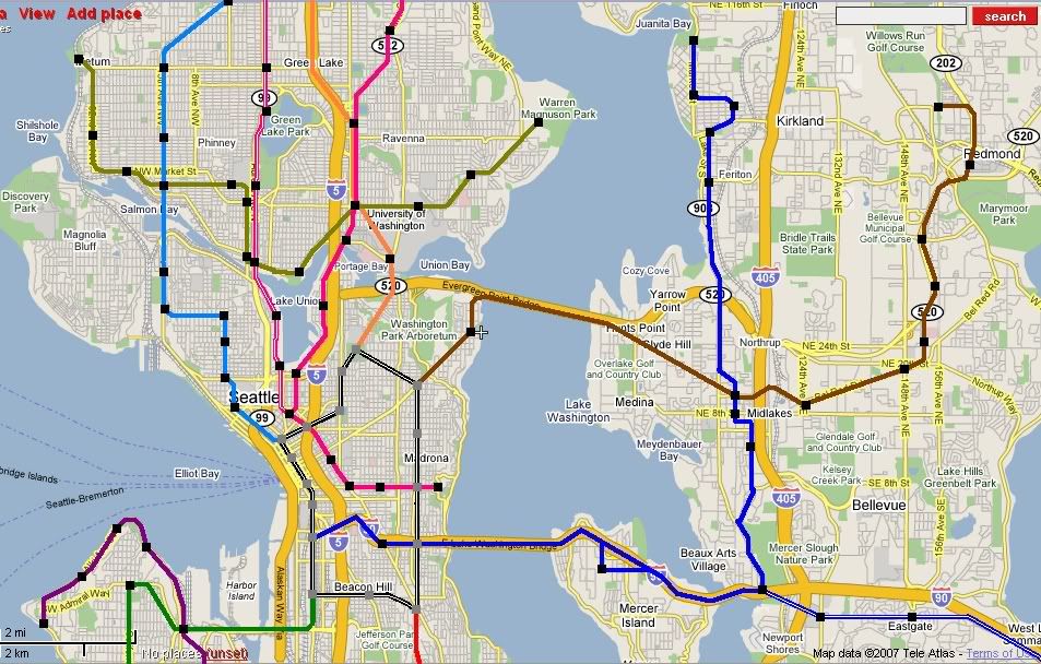
At the center of the system I'd like a large loop, denoted in black and white. All of the major lines in the system would originate from this loop. To the northwest the Cyan line would go through Belltown into Lower Queen Anne, then under Queen Anne proper, turn west and run on 15th Ave through Interbay and into Ballard continuing north into Shoreline and possibly farther. To the northeast, the Orange line (which is the North-Link) would move from Capitol Hill to the U District and follow the I-5 corridor into Snohomosh County. The Gold line would go from Golden Gardens Park through Ballard, Wallingford, Fremont, the U District and end at Magnuson Park.

The central part of the system is what I'd add the most to. The Blue Line would follow I-90 into Bellevue, turn north into Bellevue's downtown crossing the brown line, and then continue to Kirkland. The Brown line would originate on the loop and follow Madison toward Madison Park, then turn north and join SR 520 going east. Once on the Eastside, it would cross the Blue line in downtown Bellevue, then follow the Link-East route along Bel-Red into Overlake and eventually downtown Redmond. The Pink line would originate in Leschi Park, travel west, then turn northwest under Boren into Belltown. In Belltown it would split with one branch going up Eastlake to the U District and eventually toward Lake City. The other branch would follow Dexter into Fremont and parallel Aurora.

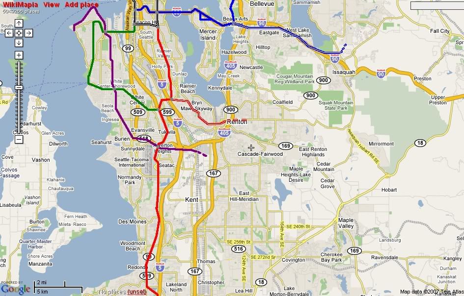
To the southeast is the Red line, essentially covering the original leg of Sound Transit's Link system, following MLK, then moving on to the airport and eventually Tacoma. Before the Red line crosses I-5, I'd have a branch move east into Renton and possibly farther. The the southwest I'd have two major West Seattle lines. The Green line originating from the loop, following the West Seattle Bridge, meeting the Purple line around Luna Park, then going underground and mostly following California Ave from Admiral Junction to Alaska Junction and then Morgan Junction where it turns toward the Ferry Dock, then back toward White Center crossing the Purple again and meeting the Red. The Purple line would run from Alki Point along the beaches to Luna Park, then follow Delridge Way to Burien, turns east to the airport and Southcenter and possibly farther.
